Groundwater monitoring
Groundwater dependent ecosystem monitoring
As part of the monitoring conducted under the Water Allocation Plan (WAP), the Eyre Peninsula Landscape Board has developed a program that has established a baseline for a group of Groundwater Dependent Ecosystems (GDEs) within the Southern Basins and Musgrave Prescribed Wells Areas. These GDEs are being monitored for changes in flora condition, groundwater level and salinity.
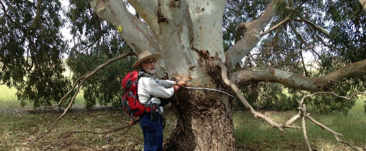
Red Gum monitoring
Many Red Gum (Eucalyptus camaldulensis) on the southern Eyre Peninsula rely on groundwater for some or all of their water needs. The Eyre Peninsula Landscape Board is monitoring Red Gum populations in Musgrave (Polda, Bellevue and Bramfield) and Southern Basins (Uley Wanilla) Prescribed Wells Areas. We also monitor a control site for Wanilla outside of a Prescribed Wells Area near Coulta. This monitoring occurs each spring and will provide an understanding of the impacts of groundwater use on ecosystem health.
Details of the methods used to determine Red Gum health are outlined in the Manual for the visual assessment of lower River Murray floodplain trees: River Red Gum (Eucalyptus camaldulensis).
The Red Gum conditions monitored between spring 2016 and spring 2018, are detailed here: 'Eyre Peninsula Groundwater Ecosystems Data Analysis: Red gum tree conditions data (five sites)' report here (7MB). Detailed monitoring data is available on request.
Report cards summarising the results of monitoring
2022
- Overview of Eyre Peninsula Groundwater Dependent Ecosystem (GDE) report cards 2022
- Bellevue - EP Red Gum GDE monitoring site report card 2022
- Bramfield - EP Red Gum GDE monitoring site report card 2022
- Coulta - EP Red Gum GDE monitoring site report card 2022
- Polda - EP Red Gum GDE monitoring site report card 2022
- Wanilla - EP Red Gum GDE monitoring site report card 2022
2021
- Overview of Eyre Peninsula Groundwater Dependent Ecosystem (GDE) report cards 2021
- Bellevue- EP Red Gum GDE monitoring site report card 2021
- Bramfield- EP Red Gum GDE monitoring site report card 2021
- Coulta - EP Red Gum GDE monitoring site report card 2021
- Polda - EP Red Gum GDE monitoring site report card 2021
- Wanilla - EP Red Gum GDE monitoring site report card 2021
2020
- Overview of Eyre Peninsula Groundwater Dependent Ecosystem (GDE) report cards 2020
- Bellevue - EP Red Gum GDE monitoring site report card 2020
- Bramfield - EP Red Gum GDE monitoring site report card 2020
- Coulta - EP Red Gum GDE monitoring site report card 2020
- Polda - EP Red Gum GDE monitoring site report card 2020
- Wanilla - EP Red Gum GDE monitoring site report card 2020
2019
- Overview of Eyre Peninsula Groundwater Dependent Ecosystem (GDE) report cards 2019 (528KB)
- Bellevue - EP Red Gum GDE monitoring site report card 2019 (761KB)
- Bramfield - EP Red Gum GDE monitoring site report card 2019 (824KB)
- Coulta - EP Red Gum GDE monitoring site report card 2019 (680KB)
- Polda - EP Red Gum GDE monitoring site report card 2019 (705KB)
- Wanilla - EP Red Gum GDE monitoring site report card 2019 (758KB)
2018
- Overview of Eyre Peninsula Groundwater Dependent Ecosystem (GDE) report cards 2018 (403KB)
- Bellevue - EP Red Gum GDE monitoring site report card 2018 (815KB)
- Bramfield - EP Red Gum GDE monitoring site report card 2018 (873KB)
- Coulta - EP Red Gum GDE monitoring site report card 2018 (766KB)
- Polda - EP Red Gum GDE monitoring site report card 2018 (788KB)
- Wanilla - EP Red Gum GDE monitoring site report card 2018 (808KB).
Wetland monitoring
The Eyre Peninsula Landscape Board is also monitoring wetlands (Pillie Lake and Sleaford Mere) in the Southern Basins Prescribed Wells Area.
This monitoring is undertaken to provide an understanding of the impacts of groundwater use on ecosystem health, and answer the monitoring question: “Are GDEs in the Prescribed Well Areas (PWA) changing in condition and if so, do these changes show increased risk from nearby groundwater extraction?”
GDE Wetland condition was assessed between December 2016 and September 2018 to establish a baseline at these monitoring sites.
While monitoring has been occurring, the technique and regime of monitoring still hasn’t been finalised. So in late 2019 a study was undertaken to:
- analyse the wetland data collected so far and provide recommendations; and
- provide advice in relation to the current monitoring design.
Here is the final report for this study: ‘Eyre Peninsula Groundwater Dependent Ecosystem Data Analysis: Wetland condition data for Lake Pillie and Sleaford Mere’ (2.4MB).
The study determined that while the current monitoring methods are generally scientifically robust, they are not answering the monitoring question and need to be refined.
As a result of these findings, the EP Landscape Board has modified the monitoring method to survey additional GDE wetlands, but visit them less frequently. The modified monitoring method was implemented from spring 2020. Following completion of the 2020 monitoring, report cards are produced to summarise the results.
Groundwater monitoring resources and reports
- WaterConnect is your portal to the latest information about South Australia's water resources, providing you with direct access to water-related publications and data. For yearly reports on the groundwater status please search via the interactive map in this link.
- Long-term groundwater level and salinity data for Musgrave and Southern Basins Prescribed Wells Areas can be accessed here.
- Real time rainfall data for several sites across Eyre Peninsula can be accessed here.
- As part of the mid-term evaluation of the WAP, we have a summary of key data collected for the period 2015 to 2020, under the Monitoring, Evaluation, Reporting and Improvement (MERI) Plan.